At least, that’s what Twitter data is telling a Humboldt State University professor and her student, Montse Compa. They took a look at over 10 million tweets during Wednesday’s Presidential Debate, and then mapped them by location.
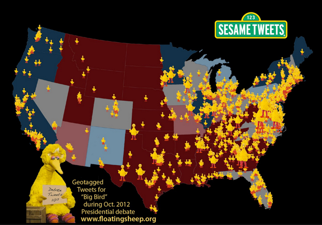
The result? A slew of large Big Birds up and down the East Coast, and extending through the South into Texas. The Midwest also shows a scattering of interest, as do the large population centers on the West Coast. (The map includes counties with more than 10 tweets referring to “Big Bird”; the larger the bird, the larger the percentage of the population tweeting about Big Bird.)
The map is available on Professor Stephens’ blog – floatingsheep.org – along with other all-time tweet-map favorites like “The Great American Pizza Map” and “Church, Bowling, Guns and Strip Clubs.” There are also three other debate-related maps developed by Stephens’s students.
Stephens cautions that the map doesn’t show whether the Big Bird tweets were positive or negative. It also doesn’t show whether tweeters agreed with the idea that one could both like Big Bird, and be willing to cut PBS subsidies.
Stephens, a Geography instructor at HSU, develops the Internet visualization maps at floatingsheep.org along with her colleagues at University of Kentucky, University of Oxford and Clark University.