Celebrating the diversity of mapmaking, it showcases how Cal Poly Humboldt students explore place, identity, and the environment.
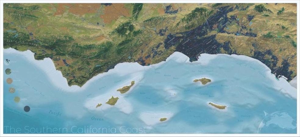
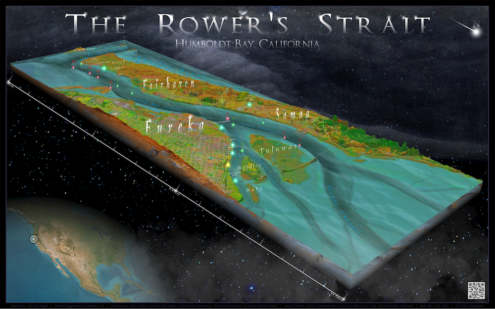
Created by the Department of Geography, Environment & Spatial Analysis and dedicated entirely to student mapmaking, this issue of Humboldt Geographic captures a broad range of map designs, including depictions of terrain and landscape, Indigenous languages and territories, animal migrations, wildfire behavior, energy infrastructure, and even shark attacks or fictional landscapes in captivating visual designs
“This edition demonstrates the visual medium of maps,” says Geography Professor Nick Perdue, faculty advisor for the magazine. “The collection is a testament to the creativity and precision students put into their work, and highlights how cartography fits into the geospatial curriculum at Cal Poly Humboldt.”
The magazine features 40 original student maps, many of which have won awards at the state, national, and international levels.
The issue features a range of work that blends technical skill with artistic expression. Some students used geographic information systems (GIS) and remote sensing to analyze data and create maps that communicate spatial patterns and geographic processes. In contrast, others experimented with hand-drawn or digital illustrations. Together, their work reflects the department’s commitment to exploring the many ways geography shapes human experience and how those unique experiences and perspectives can be visualized with craft and technique.
The magazine also highlights the department’s commitment to hands-on learning and real-world engagement. Interwoven with the student maps are accounts of field experiences, public cartography projects, and conference travels.
The Geospatial program is hosting a GIS Day conference on November 19th from 11 a.m.-4 p.m. on the second floor of the Library, and invites all people interested in cartography and the Geospatial program at Cal Poly Humboldt to come by to view student work, learn more about the program, and meet the faculty.
For more information about GIS Day, visit arcg.is/0zjWf12. The Special Edition: Cartography is available to read online at online.fliphtml5.com/HumboldtGeographic/eakt